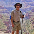
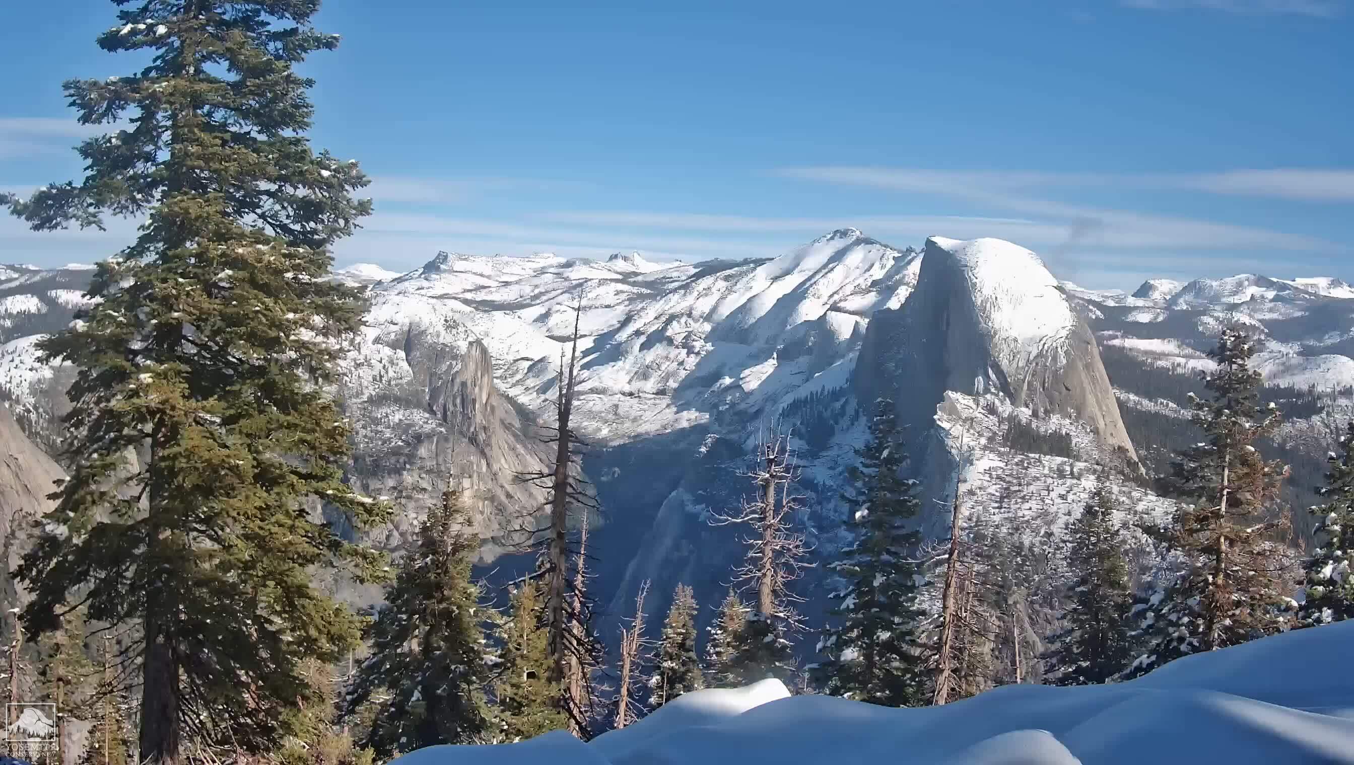
Hiking Club was at Mammoth Lakes Aug 16-19, and on Saturday ten of us climbed Clouds Rest, the nearly 10000' high summit behind and much higher than Half Dome. What a view! I've yet to find a better vantage point to take in so much of Yosemite. From here one can look straight down the Yosemite Valley, as well as view all the high Sierra peaks behind. It's a 14-mile R/T hike to Clouds Rest, so you need to plan for most of or all of a day.
If you view the photo in full size mode, you can see the track worn by hikers who for decades have used the cable route on HD's east side. Just off the brow of HD you can see Sentinel Dome, home of the Sentinel Dome webcam (look here, just to the left of Half Dome, during daylight hours, for that view).
Thursday, August 23, 2012
Sunday, July 29, 2012
Meysan Basin
The setting sun brightly illuminates the west face of Lone Pine Peak in this panorama shot, July 21 on a trip to climb Mt Irvine.
Thursday, July 26, 2012
John Muir Trail: Kearsarge Lakes to Whitney Portal
July 2 - 8, six days, group of five, 50 miles. (video). No rain, no mosquitoes, no snow, no troubles, just lots of beautiful Kings Canyon backcountry scenery. This segment, accessed from the east side over 11,800' Kearsarge Pass, also includes 13,200' Forester Pass (the highest point on the PCT) 13,770' Trail Crest, and the spur trail to the 14,505' Mt Whitney summit. I've now hiked 76 miles, or about a third of the John Muir Trail.
![]() |
| Day 1: Bullfrog Lake |
![]() |
| Tyndall Creek |
![]() |
| Forester Pass |
![]() |
| Day 4: Camp at Guitar Lake, on the west side of Mt Whitney |
![]() |
| Day 5: On Mt Whitney |
Sunday, July 1, 2012
Hiking Club on Mt San Jacinto
On the summit of San Jacinto Peak with Hiking Club, June 23. Weather was perfect, not hot, but sunny and very clear. All 12 of our party summitted, this hike was 11 mi R/T from the top of the Palm Springs Tram. A good time was had by all.
Tuesday, June 12, 2012
PCT Workday
After a day spent treading and clearing the PCT, in the Station Fire area of Section D. An outstanding group of volunteers!
Friday, June 1, 2012
Pull My Finger
Here I am, demonstrating the power of a single finger, and with nine to spare, I shall be a rock-climbing force to be reckoned with. In a climbing class with friends, Memorial Day Weekend at Joshua Tree.
Friday, May 18, 2012
April 27 / 28 Paddle Trip in Black Canyon, NV
Black Canyon is the segment of the Colorado River from Hoover Dam to Willow Beach (on Lake Mohave). Just 12 miles, it's a fun paddle trip but by stopping for hikes it can be stretched out to an overnight trip. Black Canyon has hot springs on both sides, and visitors have improvised pools to capture the water in the canyon bottoms. There are desert bighorn sheep (we saw some) and lots of waterfowl. Put-in is underneath the spectacular new concrete arch bridge that bypasses Hoover Dam. After the trip we overnighted in Boulder City NV, a great old town with no gambling, and toured the dam's powerhouse. Here's the video.
Thursday, April 5, 2012
Hike to the Top of Yosemite Falls
Here's Paully and me after hiking to the top of Yosemite Falls. What a view! It's the tallest waterfall in North America. See my Quicktime video of points along the hike here.
Sunday, March 25, 2012
Hiking Club on the Mt Lowe Railway Loop
17 came out for our March 24 hike on the old railway bed of the Mt Lowe Electric Railway. The 12 mile hike takes in several historic sites including this one on Echo Mountain, site of a hotel that burned down in 1900. In the foreground you can see the rails, still in the ground, that millions of people rode on, up until the 1930's.
Thursday, March 1, 2012
Hiking Club in LA
The February Hiking Club outing was again to downtown LA, to see old Main Street on an LA Conservancy tour. Yes, Los Angeles has a Main Street, and it is getting revitalized with new loft housing these days. Until just a few years ago, it was a Skid Row; now new people are moving into the neighborhood and occupying the rehabbed buildings.
Sunday, February 12, 2012
Archaeology Hike in the Sierras
This weekend was accompanying Mike The Desert Rat to our stomping grounds in the south Sierras in the shadow of Lamont Peak. Today Mike was touring a small archaeology group to our previous finds. The archaeologists pointed out to us many things we'd previously missed, such as bedrock mortars, grinding slicks, and more paintings (like the one pictured above, which was under an overhang). Amongst all the lithic scatter, I even picked up an artifact that turned out to be a broken obsidian spear point. One archaeologist explained how we could know that and why. I don't collect artifacts, I consider it unsavory, so after photographing this point it was left where I found it.
Sunday, January 29, 2012
At Will Rogers State Park
Saturday, January 14, 2012
Happy New Year
Saturday, December 10, 2011
Dec 10: Full Moon over the San Gabriels
A screen grab tonight from the towercam on Mt Wilson. It's arguably the most interesting web cam in Southern CA, and it captures great nighttime images too.
Saturday, December 3, 2011
Dec 3: Point Dume
Sunday, November 27, 2011
Nov 26 Sunset

I snapped this photo of the crescent moon and Venus from the summit of Mt Hollywood last night. (Video, no sound)
Nov 13: Hike in the Zabriskie Hills

During a weekend trip to Death Valley, I and intrepid hiking companion Nina climbed Manly Beacon in the Zabriskie Hills. On the way up, a Meetup group from Las Vegas passed us, so they were on top when we arrived. (Video, no sound)
Sunday, October 9, 2011
Night Hike in the Hollywood Hills

On October 8, twelve Hiking Club members hiked to the summit of Mt Lee, site of the famous Hollywood sign. This was my first hike up there at night. The sunset was incredible and after the storms this week the weather was perfect, with clear dry air and temps in the 60's. The views of Hollywood and downtown LA were incredible.
Friday, September 9, 2011
Mt Williamson in the Sierras
For years I've driven up the Owens Valley and looked up at 14,375' Mt
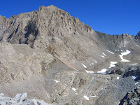
Williamson, and wondered about climbing it - the 2nd highest peak in the Sierras. After Inyo NF changed the rules this year to permit climbers access to the area in late summer, we discussed it and got a permit for Labor Day Weekend this year.
It's a far tougher climb than Mt Whitney, owing to:
1. Mt Whitney has a maintained trail constructed to its summit, while Williamson has a CL2-3 route;
2. Mt Whitney's trailhead is at elev 8000', while access to Mt Williamson is by the Shepherd Pass trailhead at 6300'; and so
3. Williamson's distance, terrain, and elevation gain are all much more demanding.
Our permit was for 5 days. While some experienced climbers can cover the 29 miles / 8000' of gain in a single day, we're not them. So this trip's schedule was two days each way, with a long summit day in the middle. Our foursome camped at 12000', as close as practical to the mountain, and we STILL spent 13 hrs to summit and return to camp.
Photo above shows the Williamson bowl and the mountain's spectacularly irregular and intimidating west face. Photos below: opposing Mt Tyndall, with its much more organized geometry (and ominous Batman shadow), the view down the west side chute; and Mark, Nina, Michelle and me on the summit.
You can view the video here.


Williamson, and wondered about climbing it - the 2nd highest peak in the Sierras. After Inyo NF changed the rules this year to permit climbers access to the area in late summer, we discussed it and got a permit for Labor Day Weekend this year.It's a far tougher climb than Mt Whitney, owing to:
1. Mt Whitney has a maintained trail constructed to its summit, while Williamson has a CL2-3 route;
2. Mt Whitney's trailhead is at elev 8000', while access to Mt Williamson is by the Shepherd Pass trailhead at 6300'; and so
3. Williamson's distance, terrain, and elevation gain are all much more demanding.
Our permit was for 5 days. While some experienced climbers can cover the 29 miles / 8000' of gain in a single day, we're not them. So this trip's schedule was two days each way, with a long summit day in the middle. Our foursome camped at 12000', as close as practical to the mountain, and we STILL spent 13 hrs to summit and return to camp.
Photo above shows the Williamson bowl and the mountain's spectacularly irregular and intimidating west face. Photos below: opposing Mt Tyndall, with its much more organized geometry (and ominous Batman shadow), the view down the west side chute; and Mark, Nina, Michelle and me on the summit.
You can view the video here.


Tuesday, August 30, 2011
7 Days in the Sierras: THE MOVIE!
Am posting a Quicktime video of our time in the Ansel Adams Wilderness. You can turn down the sound, since there's some loud wind in it. The last bit is a 360 from the summit of Mt Donahue.
Subscribe to:
Posts (Atom)