Saturday, June 19, 2021

May 22 High Desert Rock Art

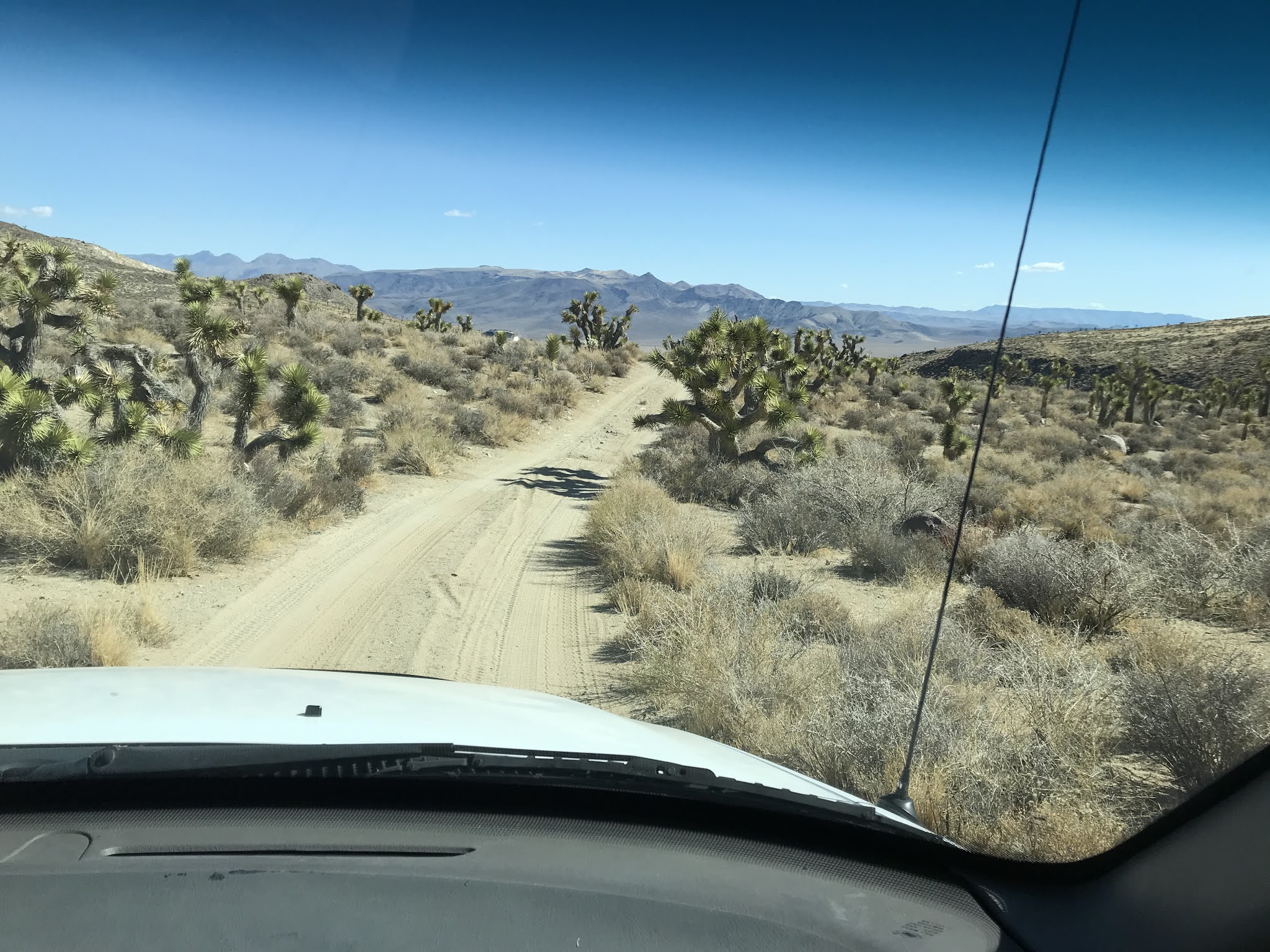
Our group of six was out to camp and hike to rock art sites in the Mojave. But characteristically, cold weather showed up, as it does so often in late May.

That's snow down to about 8000'

Bighorns are the popular motif out here

More bighorns

The archaeologists say Paiute-Shoshone medicine men pecked them into these basalt boulders roughly a thousand years ago

Lots of lithic scatter out here, from local obsidian sources

This rock is covered in images

There's also wild horses and burros out here. They are destructive and have displaced the bighorns and the BLM has to do periodic roundups

A wide-angle view of the area

These are older and cruder-looking images. Some of these probably date to pluvial times when Sierran glaciers retreated into their upper basins. So these are potentially over ten thousand years old.

We looped back to camp on this higher route that dropped into another canyon. Snow flurries fell on us for a little bit up here


Nights were cold, but driving out Sunday the sunshine felt good

Thursday, June 17, 2021

Spring 2021 Outings

 Well, here we are finally coming out of hibernation.

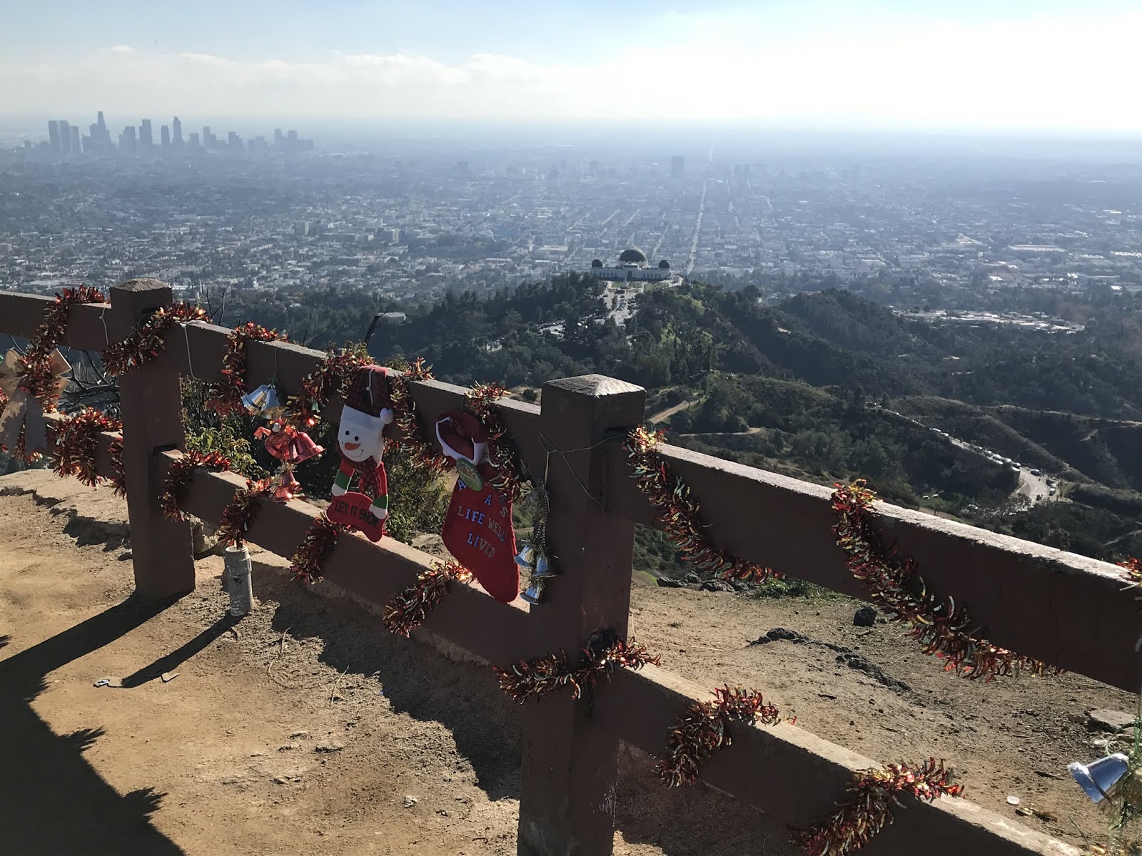
I never tire of the view of DTLA from Griffith Park
In February, Hiking Club did a fun loop hike in Griffith Park, with warm sunshine and green hills. I think February is my favorite month to hike.

In March the outing was to Malibu Creek SP where we visited the MASH site.


In May we climbed San Gabriel Peak, pointing out above the coastal marine layer.

In June we climbed Echo Mountain and saw a vivid double solar halo.


Sunday, February 7, 2021

Miscellaneous Other 2020

 2020 was the year of staying home, and aside from the August pack trip in the Sierras I stayed pretty close to home. I went into LA only a handful of times, even.

Sunrise from Mt B-P
In July I threw my pack together and hiked up Mt Baden-Powell to overnight. I saw comet Neowise but couldn't capture a picture of it. I cowboy camped under these 2000 y/o limber pines on the 9400' summit, it was a quiet night and pretty sunrise. 

Sunset above Hollywood, with the Griffith Observatory

 This summer was hot and trails were crowded, so I hiked more than usual at night, and got a lot of great photos.

Greater LA from Echo Mountain 
Greater LA from Echo Mountain  

Sunrise over the desert, taken on the way to work. Mt Baden-Powell is one of those peaks back there.

On a hike in November to Nightmare Gulch. I'm looking down into mud caves here.

Down inside one of those mud caves.

Christmas Day, atop Verdugo Peak with a view over the Santa Monicas and out to the Channel Islands, almost 70 miles distant.

Saturday, August 29, 2020

Sierras 2020: Golden Trout Wilderness / Sequoia NP 6-Day Loop

Our 2020 Sierra trip was smaller, and simpler due to the travel risks of covid.  But we fashioned a six day loop hike in August that kept an emergency bailout to a one day hike for safety. This time we took advantage of the relative solitude and some seldom-used trails in Golden Trout Wilderness. And we did a little cross-country travel into Sequoia NP on Day 4.

Golden Trout Wilderness!
Our loop hike in GTW, looking SSW with exaggerated relief

 With backpacking so popular this summer, we still were able to hike for two days without seeing anyone. The GTW comprises 474 square miles (!) of south Sierra forests, rivers, meadows and peaks immediately south of the start of the 'high' Sierra and Sequoia NP.  Elevations on our trip were still 9000 - 11000', and our timing luckily fell between mosquito season and the breakout of a hundred fires on August 19 that lasted for many weeks and made breathing smoke intolerable.

Beautiful alpine Miter Basin in Sequoia NP
We spent the first half of the loop hiking through meadows in the GT before making a camp on Rock Creek and spending Day 4 hiking into Miter Basin. This place is a true joy to visit, and while we did see 3 or 4 other people this time, on previous trips we might see one or none. 
  

Looking NNE into the basin


Sunday, February 2, 2020

Hiking in Downtown LA

Our club's February hike was another guided tour by the LA Conservancy. Now, while we were hiking through the central business district, I knelt down to get this photo of our guide, and then later some club members said they liked it. And, the more I looked at it the more I like the multiple parallel alignments, converging lines, bluebird sky and reflected illumination. I'm not known for great photos, but I think this is one of my favorites. I sent it to the Conservancy with permission to use, and was told they're interested to use it.


Sunday, January 12, 2020

New Year's Day hike to the Hollywood Sign

Hiking Club was out there on NYD, to enjoy perfect hiking weather in the world's greatest park! Stops included the Hollywood sign on Mt Lee and the Batcave
Photo by Fran R.
 While on the mountain we waved for our selfie at the Hollywood Sign Webcam. One of the cams is mounted on the water tank down there, above the second 'O'.

That's us waving

On the hike back down, you can see the cavity that is Bronson Quarry


"Atomic batteries to power.... turbines to speed..."


Sunday, December 29, 2019

Holiday Hikes

With the cold and snow down to around 3000', this year's hiking was limited to lower elevations, and LA has a lot of opportunity there.

Afternoon sun shining off the bay from Topanga SP

My friend Nina was out this holiday so we hiked every day we could. On the 23rd we hiked in Towsley Canyon. On the 24th we hiked in Topanga SP to Skull Rock, overlooking Santa Monica Bay. On Christmas Day it rained and snowed, so we saw a movie in Hollywood and then ate Chinese food at the Formosa Cafe.

San Gabriels

On the 27th we met Mark to hike in the Verdugo Hills above Glendale, a good place from which to see the snow on the local mountains. I've never seen so much snow at so low an elevation.

From Mt Hollywood: DTLA and the Griffith Observatory
On the 28th we hiked in Griffith Park, to Mt Hollywood's summit, it was gorgeous and many other people were also out hiking.

Sunday, November 10, 2019

Hiking Club November Night Hike up Mt Hollywood

Sunset silhouette of the Griffith Observatory
Some of the best local conditions for sunset photos are at Griffith Park. In winter, when the sun sets over the ocean instead of behind mountains, the low horizon, elevated view and clear dry air present a magnificent breakout of prism colors.
Sunsets like this never get old for me
On the summit, looking south toward LA's west side
Hollywood Boulevard
Got 28 hikers on the summit
On the hike down

Sunday, September 22, 2019

High Five: I Finished the John Muir Trail

This year was the 65 miles between Onion Valley and South Lake, behind the highest part of the high Sierra, the Palisades. The Palisades hold the southernmost glaciers in the US and form the divide between the desert and the Kings River drainage. This year's trip was most of the trail within Kings Canyon NP.
By saving the most grueling segment for last (eight days, the 'High Five' passes around 12k), the other segments were like training outings.  With cumulative 16,000' of elevation gained and 16,000' of elevation lost, I finished with 6 Lara Bars and 23 Skittles in my bear can. I'll be happy to not eat a Lara Bar ever again.
This year the deep snowpack in the Sierra delayed us til summer's end. As it happened, the hiking gods smiled upon us, and the week of our trip was The Sweet Spot on the calendar. The skies were clear, the mosquitos minimal, and with no smoke - but the week after, it rained every day, and the first snow fell within two weeks of our finish. We got to experience the few great days of summer 2019.
The other JMT segments are available to view here.
Day 1, on the backside of Kearsarge Pass
The junction with the JMT is on the far side of Bullfrog Lake
On Day 2 we switchback above a glacial lake on the climb to Glen Pass
Tohru and Mark on Glen Pass. Two down, three to go.
We camped by the Rae Lakes. Here a bear paced through camp at midnight, but it didn't disturb anything.
Day 3 scenery, heading down to the Woods Creek bridge
Northbound scenery. A distant cascade drains a hanging valley that isn't named on maps, and doesn't even have a trail going into it
The suspension bridge at Woods Creek is way down at 8500'.  Returning to the climb in midday heat made this the most demanding part of the trip.
After a gruelling climb, Camp 3 was on a hilltop at 10800'. Day 4 we'll cross Pinchot Pass.
On Pinchot Pass by late morning. Three passes behind us now...
Descending the wide basin north of Pinchot Pass
After posing for the photo above we stopped by that lake in the background. After eating lunch my head started spinning and everything turned weird.  In ten minutes I went from "I feel funny" to flat on my back.  I slurred my words, and briefly had trouble understanding the others. Tohru correctly guessed the trouble as electrolyte imbalance, and 20 minutes after sipping a quart of fortified water I was standing up saying, "Well THAT was weird. Ready to go?"
I've seen it in others but this time it found me, attributable to the previous afternoon's high exertion. Kinda scary but afterward I was right as rain, and finished the trip OK.
Onward. By day's end we'll be on deck for Mather Pass, tomorrow. These alpine basins are the most scenic and vast in all the Sierra.
Sunset at Camp 4.
The very scenic basin on the Mather Pass approach
On the approach to Mather Pass
#4!  On Mather Pass for lunch. It's true, in photos all these passes look alike.
Nina descending Mather Pass
Two days before we crossed Mather Pass we spoke with some southbound hikers who told us of finding a hiker's body very near the location in the photo above. A man had been crossing an icy snow patch, apparently slipped and slid headfirst into the rocks below. Not even a long fall, just headfirst. He was still warm, but dead from a broken neck. They stayed with him for three hours, waiting to see if companions of his came, but nobody did. They had a satellite communicator, contacted a park dispatcher, then per their direction unpacked his sleeping bag, placed him in it and went on their way. His body was recovered before we came by.

Camp 5 was just below 11000' and the sun settled perfectly into the notch beyond Lower Palisade Lake.
Day 6: We don't have a pass today, but we'll descend the 'Golden Staircase' on Palisade Creek to the Middle Fork of the Kings River
The Golden Staircase
The 1200' descent on the Golden Staircase is infamous. Apparently this was the final segment of the JMT to be constructed.  Many / most hike it uphill, while we will hike down so ours is a pounding descent down to the lowest elevation on the trip (8072') before the climb into Dusy Basin tomorrow, setting us up to cross Bishop Pass on the next day.

We stop for lunch and Nina loves the giant tree
Deer Meadow was a very scenic and pleasant section to hike
Camp 6 in LeConte Canyon was by a wet meadow and our skeeteriest camp. None of our camps ever look like the cover photos of Backpacker magazine.

Day 7: On 8/30/19, Nina and I close out the JMT at this trail junction. We've hiked the entire trail!  I can fall down dead on the hike up to Bishop Pass and it can still be said that I finished the JMT.
Camp 7. During skeeter hour, and there's no place to hang the light, you improvise. Had a light frost overnight here.
Day 8:  Our packs are light as we climb through Dusy Basin
All smiles on #5 - Bishop Pass. We're 3 hours from the trailhead and completion of the hike. Congrats to everyone on finishing the toughest segment of the JMT.