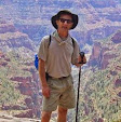
This year was the 65 miles between Onion Valley and South Lake, behind the highest part of the high Sierra, the Palisades. The Palisades hold the southernmost glaciers in the US and form the divide between the desert and the Kings River drainage. This year's trip was most of the trail within Kings Canyon NP.
By saving the most grueling segment for last (eight days, the 'High Five' passes around 12k), the other segments were like training outings. With cumulative 16,000' of elevation gained and 16,000' of elevation lost, I finished with 6 Lara Bars and 23 Skittles in my bear can. I'll be happy to not eat a Lara Bar ever again.
This year the deep snowpack in the Sierra delayed us til summer's end. As it happened, the hiking gods smiled upon us, and the week of our trip was The Sweet Spot on the calendar. The skies were clear, the mosquitos minimal, and with no smoke - but the week after, it rained every day, and the first snow fell within two weeks of our finish. We got to experience the few great days of summer 2019.
The other JMT segments are available to view
here.
 |
| Day 1, on the backside of Kearsarge Pass |
 |
| The junction with the JMT is on the far side of Bullfrog Lake |
 |
| On Day 2 we switchback above a glacial lake on the climb to Glen Pass |
 |
| Tohru and Mark on Glen Pass. Two down, three to go. |
 |
| We camped by the Rae Lakes. Here a bear paced through camp at midnight, but it didn't disturb anything. |
 |
| Day 3 scenery, heading down to the Woods Creek bridge |
 |
| Northbound scenery. A distant cascade drains a hanging valley that isn't named on maps, and doesn't even have a trail going into it |
 |
| The suspension bridge at Woods Creek is way down at 8500'. Returning to the climb in midday heat made this the most demanding part of the trip. |
 |
| After a gruelling climb, Camp 3 was on a hilltop at 10800'. Day 4 we'll cross Pinchot Pass. |
 |
| On Pinchot Pass by late morning. Three passes behind us now... |
 |
| Descending the wide basin north of Pinchot Pass |
After posing for the photo above we stopped by that lake in the background. After eating lunch my head started spinning and everything turned weird. In ten minutes I went from "I feel funny" to flat on my back. I slurred my words, and briefly had trouble understanding the others. Tohru correctly guessed the trouble as electrolyte imbalance, and 20 minutes after sipping a quart of fortified water I was standing up saying, "Well THAT was weird. Ready to go?"
I've seen it in others but this time it found me, attributable to the previous afternoon's high exertion. Kinda scary but afterward I was right as rain, and finished the trip OK.
 |
| Onward. By day's end we'll be on deck for Mather Pass, tomorrow. These alpine basins are the most scenic and vast in all the Sierra. |
 |
| Sunset at Camp 4. |
 |
| The very scenic basin on the Mather Pass approach |
 |
| On the approach to Mather Pass |
 |
| #4! On Mather Pass for lunch. It's true, in photos all these passes look alike. |
 |
| Nina descending Mather Pass |
Two days before we crossed Mather Pass we spoke with some southbound hikers who told us of finding a hiker's body very near the location in the photo above. A man had been crossing an icy snow patch, apparently slipped and slid headfirst into the rocks below. Not even a long fall, just headfirst. He was still warm, but dead from a broken neck. They stayed with him for three hours, waiting to see if companions of his came, but nobody did. They had a satellite communicator, contacted a park dispatcher, then per their direction unpacked his sleeping bag, placed him in it and went on their way. His body was recovered before we came by.
 |
| Camp 5 was just below 11000' and the sun settled perfectly into the notch beyond Lower Palisade Lake. |
 |
| Day 6: We don't have a pass today, but we'll descend the 'Golden Staircase' on Palisade Creek to the Middle Fork of the Kings River |
 |
| The Golden Staircase |
The 1200' descent on the Golden Staircase is infamous. Apparently this was the final segment of the JMT to be constructed. Many / most hike it uphill, while we will hike down so ours is a pounding descent down to the lowest elevation on the trip (8072') before the climb into Dusy Basin tomorrow, setting us up to cross Bishop Pass on the next day.
 |
| We stop for lunch and Nina loves the giant tree |
 |
| Deer Meadow was a very scenic and pleasant section to hike |
 |
Camp 6 in LeConte Canyon was by a wet meadow and our skeeteriest camp. None of our camps ever look like the cover photos of Backpacker magazine.
 |
| Day 7: On 8/30/19, Nina and I close out the JMT at this trail junction.
We've hiked the entire trail! I can fall down dead on the hike up to Bishop
Pass and it can still be said that I finished the JMT. |
|
 |
| Camp 7. During skeeter hour, and there's no place to hang the light, you improvise. Had a light frost overnight here. |
 |
| Day 8: Our packs are light as we climb through Dusy Basin |
 |
| All smiles on #5 - Bishop Pass. We're 3 hours from the trailhead and completion of the hike. Congrats to everyone on finishing the toughest segment of the JMT. |