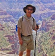
 8000' Iron Mountain (MAP) isn't the tallest peak in the San Gabriels, but the guidebook calls it the toughest dayhike in the range. Its elevation, remoteness, low trailhead elevation, rollercoaster ridgeline route, steepness, and lack of a summit trail combine to make it tough. So on Friday with hiking compadre Nina we tried this 6000' climb. It's a 15-mile day that took 13 hours.
These guys posted some funny reviews of the Iron Mountain experience.
The 2000' trailhead is in the East Fork of the San Gabriel River. The first 2500' or so ascends the southwest ridge. This ridge has 8 or 10 bumps on it, so you keep ascending and then losing elevation, sometimes a lot, so you probably end up climbing an extra 1000' or so on this hike on top of the 6000 feet of climb. The ridgeline is covered in brushy chaparral, not impenetrable but hot and exposed. At mile 5 it gets more unfriendly, climbing the remaining 3400 feet in 2.5 miles with no real trail. The grade in places probably exceeds 3000fpm, easily fitting into the category of 'scrambling'. The summit view (video) is probably among the best in the range. The tricky descent took the same time as the ascent - 6 hours. We returned to the trailhead at 9pm, the final two miles with headlamps.
While it tops out at just 8000' elevation, in some ways this climb rivals the Mt Whitney mountaineers' route in difficulty.


3 comments:
Beauty movie, eh! Now just a Google Map with the little indicator. Then the world will really sit up and take notice. Thanks, Jackie, that was great!
OK, map is now included!
Thanks for the video view from the summit, Kevin. Great quality. I would definitely like to do this one...Dave
Post a Comment